
Highlights:
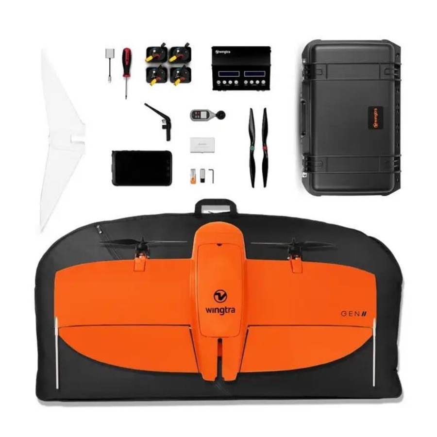
Flight Time:59 Minutes
Maximum Speed:36 MPH
Maximum Wind Resistance:12 m/s
Wingtra Gen II The Wingtra Gen II is a fixed-wing VTOL drone built for aerial mapping and survey missions. It is recognized for data accuracy, VTOL capabilities, and integration with high-end cameras. In the Indian market, the Wingtra Gen II is priced around INR 2,500,000.
• Mining and Quarry Management: Provides accurate volumetric measurements, terrain modelling, and site monitoring.
• Urban and Infrastructure Mapping: This mapping captures detailed orthomosaics and 3D data for roadworks, city planning and inspections.
• Environmental Monitoring: Supports multispectral imaging for vegetation health and land change detection.
• Agricultural Surveying: Helps produce NDVI maps and evaluate crop health.
• Disaster Response and Planning: Offers precise geospatial data in difficult-to-access areas.
Not sure which drone fits your needs? Our experts can guide you to the perfect UAV for your mission.
Browse similar UAVs and add-ons trusted by students and professionals alike.