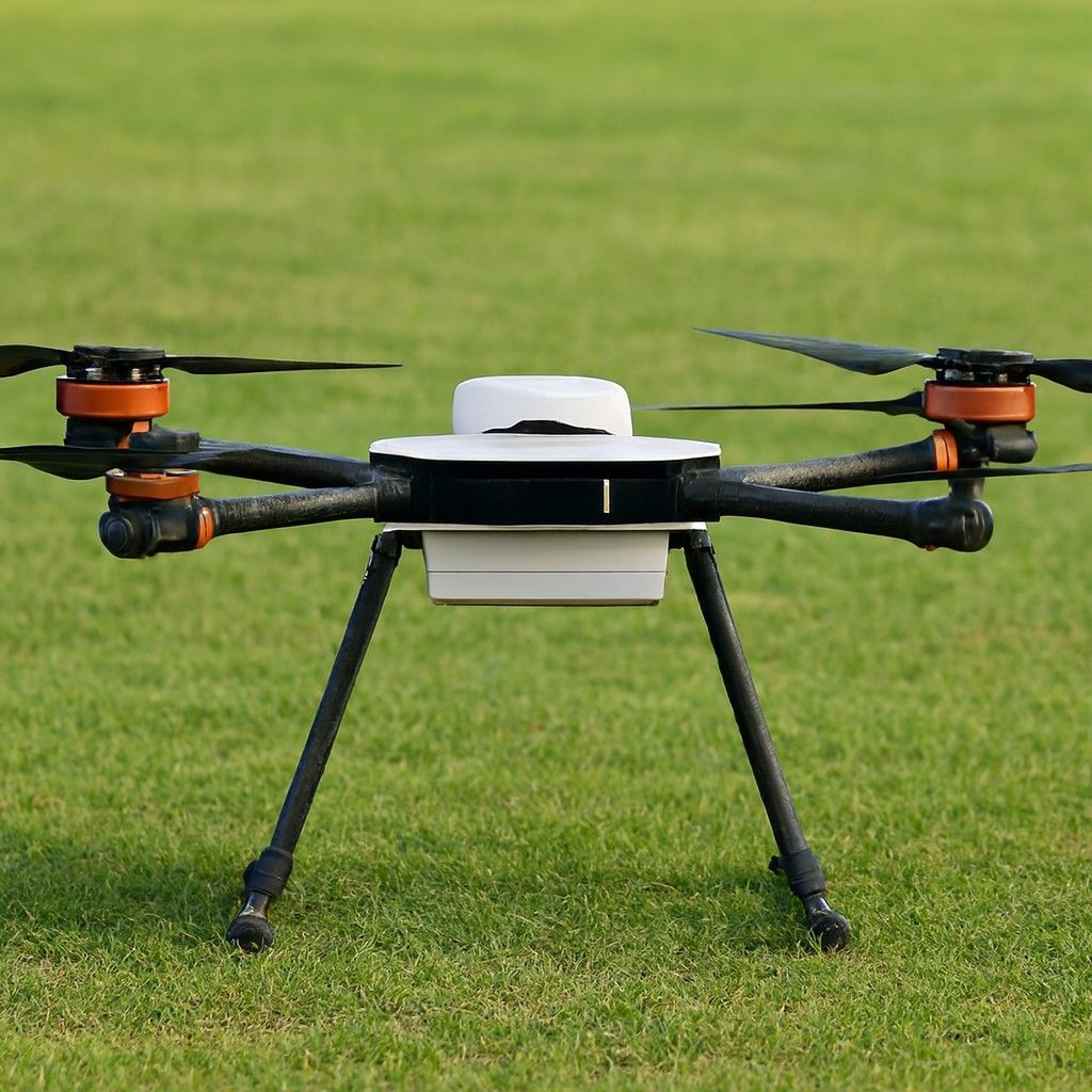
Teledyne FLIR SkyRanger R70 – Tactical Intelligence with Survey-Grade Precision - image 1
  • Teledyne FLIR SkyRanger R70 – Tactical Intelligence with Survey-Grade Precision - image 1
  • Teledyne FLIR SkyRanger R70 – Tactical Intelligence with Survey-Grade Precision - image 2

Teledyne FLIR SkyRanger R70 – Tactical Intelligence with Survey-Grade Precision

Highlights:

  • Weight:Approx. 5.4 kg

  • Battery Time:45 minutes

  • Max Video Resolution:HD 1080p (EO), with advanced IR thermal options

  • Manufacturer Warranty
  • support Expert Support
  • Free Shipping

Overview

This drone is perfect for tactical operations, industrial inspection and precision aerial data collection. The R70 combines AI capabilities, military-grade durability and modular payload flexibility. With its cutting-edge flight system and payload versatility, it’s a good option for defence forces, public safety agencies and industrial survey teams. The total cost of this drone in India is around Rs.13,00,000

Specifications

  • High-Resolution Imaging Payloads: It supports FLIR’s proprietary imaging systems, including HD EO/IR cameras for thermal and optical data, enabling operations in both day and night conditions.
  • AI-Enhanced Autonomy: It features object detection and tracking, GPS-denied navigation, and onboard AI abilities for executing complex missions in dynamic environments.
  • Multiple Payload Capacity: The R70 can carry up to three simultaneous payloads and supports 3.5 kg, providing extensive mission customization options.
  • 45-Minute Flight Time: The R70 features hot-swappable dual batteries, offering extended flight endurance and making it perfect for surveys or long surveillance.
  • Weather-Resistant Design: Rated for IP53 weather protection, the drone can operate in rain.

Use Cases

  • Tactical Surveillance & Public Safety:  It is used by defence agencies and police forces for reconnaissance, crowd monitoring and high-risk incident response.
  • Disaster Response & Search Operations:  This drone excels in SAR missions, providing superior thermal vision for assessing damage.
  • Border Security & Perimeter Monitoring: With long flight times and safe communications, it is valuable for incessant perimeter surveillance.
  • Surveying in Challenging Terrain: Perfect for 3D mapping and terrain modelling in remote or GPS-compromised areas, with pin-point accuracy.
Related Tags:
Professional Camera Drone Survey Drones

Need Help Choosing the Right Drone?

Not sure which drone fits your needs? Our experts can guide you to the perfect UAV for your mission.

Chat with Expert Schedule Call

Explore More Drone Products

Browse similar UAVs and add-ons trusted by students and professionals alike.

Share

half-star-solid phone